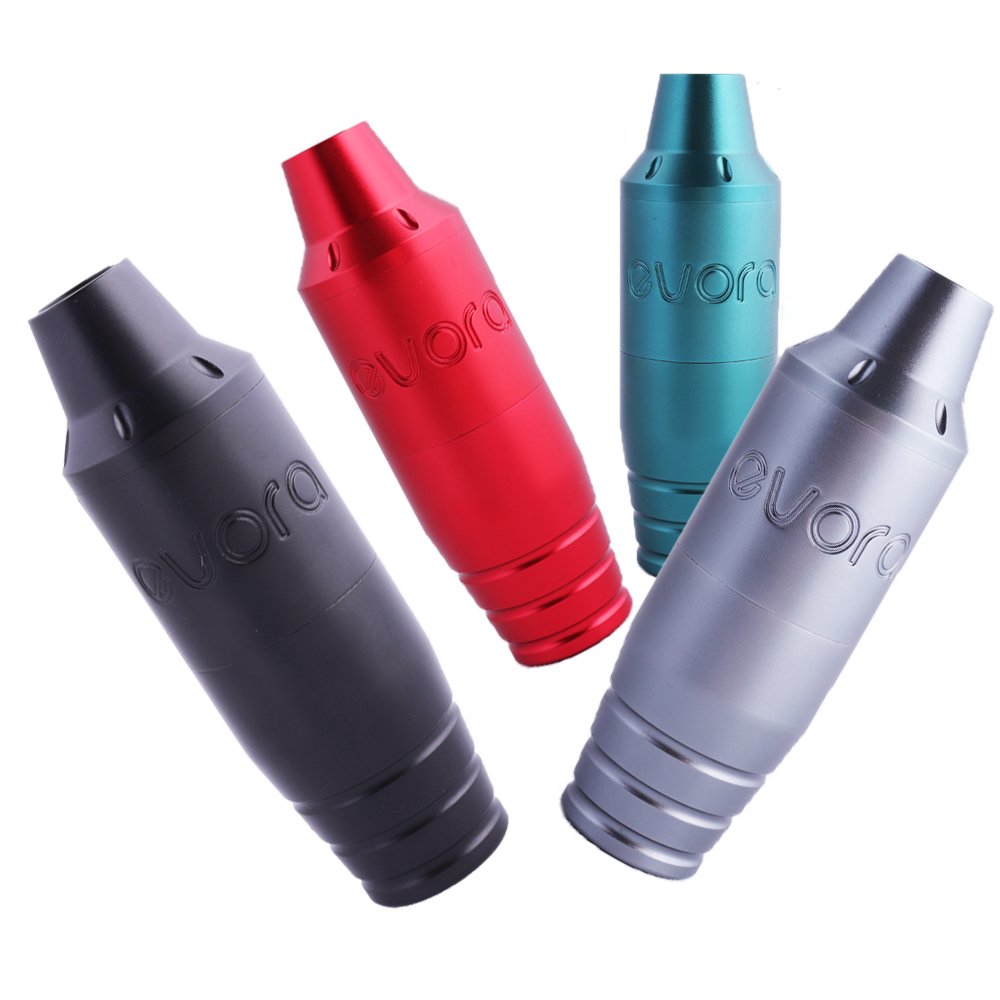
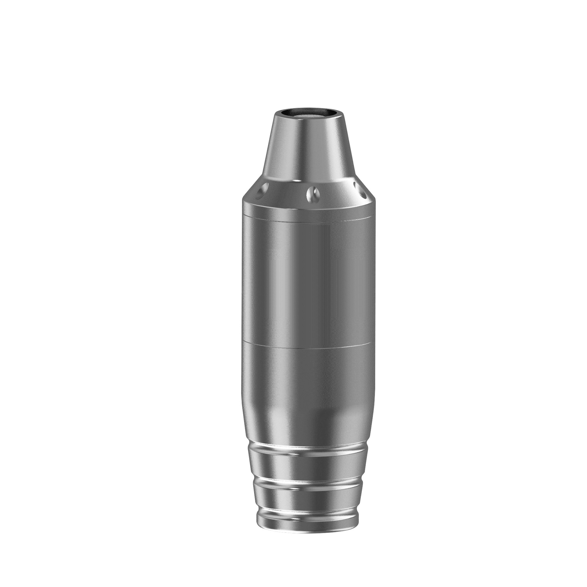
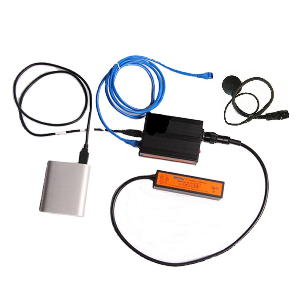
High-resolution geosurvey UAV with advanced fluxgate magnetometer sensor for precise magnetic field measurements. Durable carbon fiber frame ensures lightweight yet robust performance in harsh environments. Integrated high-precision GPS and inertial navigation system delivers centimeter-level positioning accuracy.
Professional-grade aeromagnetic survey capabilities for mineral exploration, archaeological detection, and pipeline inspection. Customizable payload configurations support various geophysical applications. Real-time data transmission enables instant field analysis and decision-making.
Industrial-grade components with IP54 waterproof rating for reliable operation in extreme conditions. Modular design allows quick maintenance and sensor replacement. Includes proprietary data processing software for efficient geomagnetic anomaly interpretation.
Low-noise electromagnetic shielding minimizes interference for ultra-sensitive measurements. Extended flight time up to 120 minutes with swappable lithium battery system. Compliant with international geophysical survey standards and aviation regulations.
Complete turnkey solution including UAV platform, sensor array, ground station, and field deployment kit. Ideal for geological survey teams, energy companies, and government research institutions. Direct manufacturer pricing with volume discounts for large-scale procurement projects.
Recent Purchase
saj***
Specification:Magnetic Sensor;
$10835.31
46 days ago
hbr***
Specification:Three axis fluxgate sensor;
$12381.09
33 days ago
krx***
Specification:Low cost fluxgate sensor;
$2725.5
14 days ago
wkx***
Specification:ADC;
$17371.32
43 days ago
kqc***
Specification:Data acquisition module;
$3208.23
44 days ago
sek***
Specification:Fluxgate magnetometer;
$16572.66
17 days ago
wxc***
Specification:three-axis magnetometer;
$11149.48
18 days ago
View All
Customer Reviews
High Resolution Geosurvey UAV-BORNE Geophysical Aerial Survey UAV Drone Magnetic Survey Geophysics Fluxgate Magnetometer Sensor
$2100$2725.5-22.95%
Specification:
Three axis fluxgate sensor
Fluxgate magnetometer
Low cost fluxgate sensor
three-axis magnetometer
ADC
Data acquisition module
Magnetic Sensor
Quantity:
Add to Cart
Wishlist
Features
See More